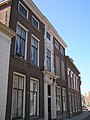
Category:'s-Heer Hendrikskinderenstraat 42, Goes
Jump to navigation
Jump to search

| Object location | | View all coordinates using: OpenStreetMap - Google Earth - Proximityrama |
|---|
 | |||||
| Instance of | house | ||||
| Location | Goes, Zeeland, Netherlands | ||||
| Located at street address |
| ||||
| Heritage designation |
| ||||
| |||||
|
|
|||||
|
This is a category about rijksmonument number 16318 |
Address
| 's-Heer Hendrikskinderenstraat 42 4461 BW Goes Netherlands |
Media in category "'s-Heer Hendrikskinderenstraat 42, Goes"
The following 3 files are in this category, out of 3 total.
 Goes Huize den Berg.jpg 1,712 × 2,288; 742 KB
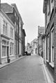 Inkijk - Goes - 20079539 - RCE.jpg 809 × 1,200; 213 KB
 Voorgevel - Goes - 20079562 - RCE.jpg 808 × 1,200; 242 KB

