Category:'t Loug 14, Spijk
Jump to navigation
Jump to search

| Object location | | View all coordinates using: OpenStreetMap - Google Earth - Proximityrama |
|---|
 | |||||
| Location | Delfzijl, Groningen, Netherlands | ||||
| Heritage designation |
| ||||
| |||||
|
|
|||||
|
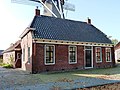
This is a category about rijksmonument number 9491 |
Address
| 't Loug 14 Spijk Netherlands |
Media in category "'t Loug 14, Spijk"
The following 3 files are in this category, out of 3 total.
 Molenberg - Spijk - 20203181 - RCE.jpg 1,200 × 1,197; 418 KB
 Spijk - 't Loug 14 - sarrieshut.jpg 3,584 × 2,688; 3.67 MB
 Voorgevel - Spijk - 20203252 - RCE.jpg 1,179 × 1,200; 276 KB

