Category:'t Voorwerf 15, Zunderdorp
Jump to navigation
Jump to search

| Object location | | View all coordinates using: OpenStreetMap - Google Earth - Proximityrama |
|---|
 | |||||
| Instance of | farmhouse | ||||
| Location | Amsterdam, North Holland, Netherlands | ||||
| Located at street address |
| ||||
| Heritage designation |
| ||||
| |||||
|
|
|||||
|
This is a category about rijksmonument number 6799 |
Address
| 't Voorwerf 15 1027 AG Zunderdorp Netherlands |
Media in category "'t Voorwerf 15, Zunderdorp"
The following 13 files are in this category, out of 13 total.
 Aanzicht - Zunderdorp - 20226132 - RCE.jpg 1,200 × 806; 246 KB
 Aanzicht - Zunderdorp - 20226134 - RCE.jpg 1,200 × 806; 183 KB
 Aanzicht - Zunderdorp - 20226135 - RCE.jpg 1,200 × 806; 240 KB
 Aanzicht - Zunderdorp - 20226136 - RCE.jpg 1,200 × 805; 299 KB
 Met schuur - Zunderdorp - 20226133 - RCE.jpg 1,200 × 807; 191 KB
 Overzicht - Zunderdorp - 20226130 - RCE.jpg 1,200 × 1,188; 359 KB
 Voor- en rechter zijgevel - Zunderdorp - 20226129 - RCE.jpg 1,200 × 1,190; 372 KB
 Voor- en zijgevel nr. GG 4 - Zunderdorp - 20478175 - RCE.jpg 1,200 × 900; 220 KB
 Voor- en zijgevel nr. GG 5 - Zunderdorp - 20478177 - RCE.jpg 1,200 × 900; 222 KB
 Voor- en zijgevel nr. Zunderdorp 4 - Zunderdorp - 20478174 - RCE.jpg 1,200 × 900; 237 KB
 Zij- en kopgevel nr. Zunderdorp 2 - Zunderdorp - 20478173 - RCE.jpg 1,200 × 900; 211 KB
 Zij- en voorgevel nr. GG 6 - Zunderdorp - 20478176 - RCE.jpg 1,200 × 900; 218 KB
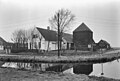
 Zunderdorp, 't Voorwerf 15.jpg 3,200 × 2,131; 1.88 MB


