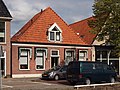
Category:'t Zand 4, Joure
Jump to navigation
Jump to search

| Object location | | View all coordinates using: OpenStreetMap - Google Earth - Proximityrama |
|---|
 | |||||
| Instance of | building | ||||
| Location | Skarsterlân, Friesland, Netherlands | ||||
| Located at street address |
| ||||
| Heritage designation |
| ||||
| |||||
|
|
|||||
|
This is a category about rijksmonument number 20843 |
Address
| 't Zand 3, 4 Joure Netherlands |
Media in category "'t Zand 4, Joure"
The following 3 files are in this category, out of 3 total.
 't Zand 4 Joure.JPG 4,032 × 3,024; 5.91 MB
 't Zand 4.JPG 4,032 × 3,024; 4.56 MB
 Voorgevels - Joure - 20121117 - RCE.jpg 1,200 × 804; 198 KB

