Category:Linguistic maps of the English language
Jump to navigation
Jump to search

Subcategories
This category has the following 2 subcategories, out of 2 total.
Media in category "Linguistic maps of the English language"
The following 63 files are in this category, out of 63 total.
 Angielski-urzedowy.PNG 659 × 360; 106 KB
 Anglaisparlé(800px).png 800 × 351; 38 KB
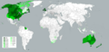
 Anglo America (orthographic projection).svg 550 × 550; 454 KB
 AnglophoneWorld.svg 863 × 443; 1.61 MB
 Anglospeak(800px)2.png 1,425 × 625; 52 KB
 Anglospeak(800px)Countries.png 800 × 351; 21 KB
 Anglospeak-percentage-knowledge.svg 841 × 426; 1.49 MB
 Anglospeak-percentage-knowledge15.svg 512 × 263; 1.41 MB
 Anglospeak.svg 940 × 477; 1.27 MB
 Anglosphere map excluding Quebec and Nunavut.png 1,427 × 628; 52 KB
 Anglosphere map.PNG 1,427 × 628; 53 KB
 Appalachian dialect region of United States.png 542 × 511; 135 KB
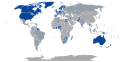
 Countries where over 50% of the population are native English speakers.png 1,800 × 820; 104 KB
 Countries with English as Official Language.png 1,366 × 710; 256 KB
 Defence Defense Labour Labor British American spelling by country.svg 1,035 × 531; 1.35 MB
 DensityOfNativeEnglishSpeakersWorldwideLogScale.png 1,427 × 628; 51 KB
 DensityOfNativeEnglishSpeakersWorldwideLogScaleBlurI.png 1,427 × 628; 30 KB
 DensityOfNativeEnglishSpeakersWorldwideLogScaleNoBorders.png 1,427 × 628; 37 KB
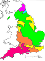
 Dialects of the british isles.jpg 517 × 600; 202 KB
 Distribution of British English.png 1,800 × 820; 100 KB
 English as main language.png 2,000 × 1,027; 183 KB
 English dialects in Ulster contrast including Drum.png 1,000 × 833; 221 KB
 English dialects in Ulster contrast.png 1,000 × 833; 179 KB
 English dialects in Ulster contrast2.png 1,000 × 833; 156 KB
 English in the countries of the world.png 1,357 × 628; 34 KB
 English Learning World.png 1,425 × 625; 58 KB
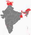 English official in India.svg 1,476 × 1,680; 227 KB
 English speakers density ZA.svg 995 × 768; 900 KB
 English speakers proportion ZA.svg 995 × 768; 899 KB
 English-as-Official-Language(v2).png 1,350 × 625; 74 KB
 English-Official and functional.png 1,425 × 625; 65 KB
 English-speaking countries.png 800 × 412; 100 KB
 Final er in Farmer English dialects.PNG 440 × 594; 33 KB
 Foot-strut split.svg 1,129 × 1,385; 115 KB
 Google Eng Accent.png 1,480 × 632; 49 KB
 H-dropping.svg 1,129 × 1,385; 113 KB
 Idioma inglés.png 560 × 684; 20 KB
 Initial fricative voicing.svg 1,129 × 1,385; 108 KB
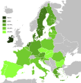
 Knowledge English EU map.png 1,218 × 1,245; 82 KB
 Knowledge of English EU map (Swedish).svg 590 × 603; 682 KB
 Knowledge of English EU map-fr.svg 1,212 × 1,242; 555 KB
 Knowledge of English EU map.svg 590 × 603; 671 KB
 Langues du Cameroun Carte.png 500 × 656; 71 KB
 LocationWHAngloAmerica2.png 550 × 550; 259 KB
 Map of English native speakers.png 1,280 × 615; 385 KB
 Ng-coalescence.svg 1,129 × 1,385; 110 KB
 Official English language in the World.svg 853 × 433; 1.26 MB
 Official Language - English.png 1,366 × 713; 158 KB
 Percentage of English speakers by country as of 2014.png 1,200 × 601; 190 KB
 Proportion of English speakers by country.svg 1,726 × 886; 1.67 MB
 RhoticEngland.png 1,144 × 1,425; 87 KB
 RhoticEngland2.png 1,144 × 1,425; 66 KB
 South Africa 2001 English speakers density map.svg 1,072 × 933; 913 KB
 South Africa 2001 English speakers proportion map.svg 1,072 × 933; 237 KB
 South Africa 2011 English speakers density map.svg 809 × 709; 1.31 MB
 South Africa 2011 English speakers proportion map.svg 809 × 709; 431 KB
 Stati per utilizzo del inglese.png 1,357 × 617; 38 KB
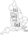
 Traditional dialect isoglosses in northern England.PNG 585 × 721; 92 KB
 US Official Language Map.svg 959 × 593; 213 KB
 Anglospeak.png 2,664 × 1,468; 124 KB
 World map percentage english speakers by country.png 3,002 × 1,551; 839 KB
 World map percentage english speakers by country.svg 634 × 477; 2.36 MB

.png)
.svg)

2.png)
Countries.png)


.png)


.jpg)


.svg)


