File:House022ElectionsMap.png
Jump to navigation
Jump to search


Size of this preview: 775 × 599 pixels. Other resolutions: 310 × 240 pixels | 621 × 480 pixels | 776 × 600 pixels | 993 × 768 pixels | 1,280 × 990 pixels | 3,297 × 2,550 pixels.
Original file (3,297 × 2,550 pixels, file size: 123 KB, MIME type: image/png)
Summary[edit]
| Description |
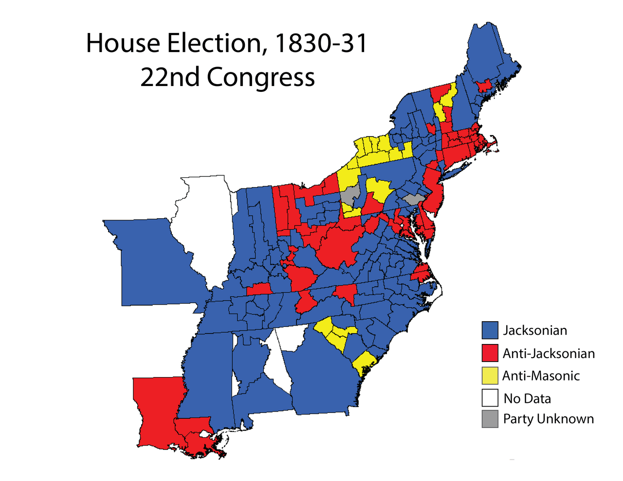
English: Map of U.S. House elections results from 1830-31 elections for 22nd Congress
|
| Date | |
| Source | Own work |
| Author | LaDale Winling |
http://www.mappingcongress.com
Licensing[edit]
I, the copyright holder of this work, hereby publish it under the following license:
|
This file is licensed under the Creative Commons Attribution-Share Alike 4.0 International license. | |
|
File history
Click on a date/time to view the file as it appeared at that time.
| Date/Time | Thumbnail | Dimensions | User | Comment | |
|---|---|---|---|---|---|
| current | 20:10, 13 July 2016 | | 3,297 × 2,550 (123 KB) | Lwinling (talk | contribs) | User created page with UploadWizard |
- You cannot overwrite this file.
File usage on Commons
The following page uses this file:
File usage on other wikis
The following other wikis use this file:
- Usage on en.wikipedia.org
- Usage on it.wikipedia.org