File:I-71 (Southbound) between Cincinnati and Louisville.jpg
Jump to navigation
Jump to search


Size of this preview: 800 × 526 pixels. Other resolutions: 320 × 210 pixels | 640 × 421 pixels | 1,024 × 673 pixels | 1,280 × 842 pixels | 4,205 × 2,765 pixels.
Original file (4,205 × 2,765 pixels, file size: 4.5 MB, MIME type: image/jpeg)
Summary[edit]
_between_Cincinnati_and_Louisville.jpg&action=edit§ion=1)
| Description |
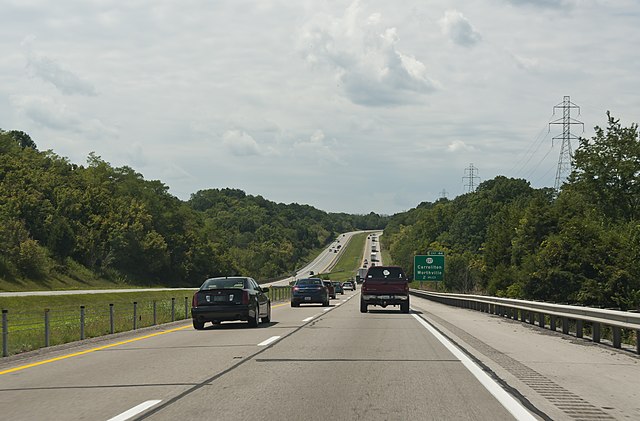
English: I-71 (Southbound) through the hills of Kentucky, between Cincinnati and Louisville around mile marker 46
|
|||||
| Date | ||||||
| Source | Own work | |||||
| Author | Sixflashphoto | |||||
| Permission (Reusing this file) |
= I, the copyright holder of this work, hereby publish it under the following license:
|
| Camera location | | View this and other nearby images on: OpenStreetMap - Google Earth |
|---|
_between_Cincinnati_and_Louisville.jpg¶ms=038.655500_N_-085.076056_E_globe:Earth_type:camera_...&language=en)
Licensing[edit]
_between_Cincinnati_and_Louisville.jpg&action=edit§ion=2)
I, the copyright holder of this work, hereby publish it under the following license:
|
This file is licensed under the Creative Commons Attribution-Share Alike 4.0 International license. | |
|

|
This image has been assessed under the valued image criteria and is considered the most valued image on Commons within the scope: Interstate 71 (Southbound) in the hills of northern Kentucky. You can see its nomination here. |
_between_Cincinnati_and_Louisville.jpg)
File history
Click on a date/time to view the file as it appeared at that time.
| Date/Time | Thumbnail | Dimensions | User | Comment | |
|---|---|---|---|---|---|
| current | 21:26, 7 September 2017 | | 4,205 × 2,765 (4.5 MB) | Sixflashphoto (talk | contribs) | Brightness and minor changes. |
| 06:36, 2 September 2017 |  | 4,205 × 2,765 (4.78 MB) | Sixflashphoto (talk | contribs) | User created page with UploadWizard |
- You cannot overwrite this file.
File usage on Commons
The following page uses this file:
File usage on other wikis
The following other wikis use this file:
- Usage on en.wikipedia.org
_between_Cincinnati_and_Louisville.jpg&oldid=258106761)
_between_Cincinnati_and_Louisville.jpg)
_between_Cincinnati_and_Louisville.jpg&action=edit&redlink=1)
_between_Cincinnati_and_Louisville.jpg&action=edit)
_between_Cincinnati_and_Louisville.jpg&action=history)
_between_Cincinnati_and_Louisville.jpg)
_between_Cincinnati_and_Louisville.jpg)
_between_Cincinnati_and_Louisville.jpg&oldid=258106761)
_between_Cincinnati_and_Louisville.jpg&action=info)
_between_Cincinnati_and_Louisville.jpg&mobileaction=toggle_view_mobile)