File:Norton Field Historical Marker 1.jpg
Jump to navigation
Jump to search


Size of this preview: 390 × 600 pixels. Other resolutions: 156 × 240 pixels | 312 × 480 pixels | 499 × 768 pixels | 666 × 1,024 pixels | 2,707 × 4,163 pixels.
Original file (2,707 × 4,163 pixels, file size: 6.73 MB, MIME type: image/jpeg)
Summary[edit]
| Description |
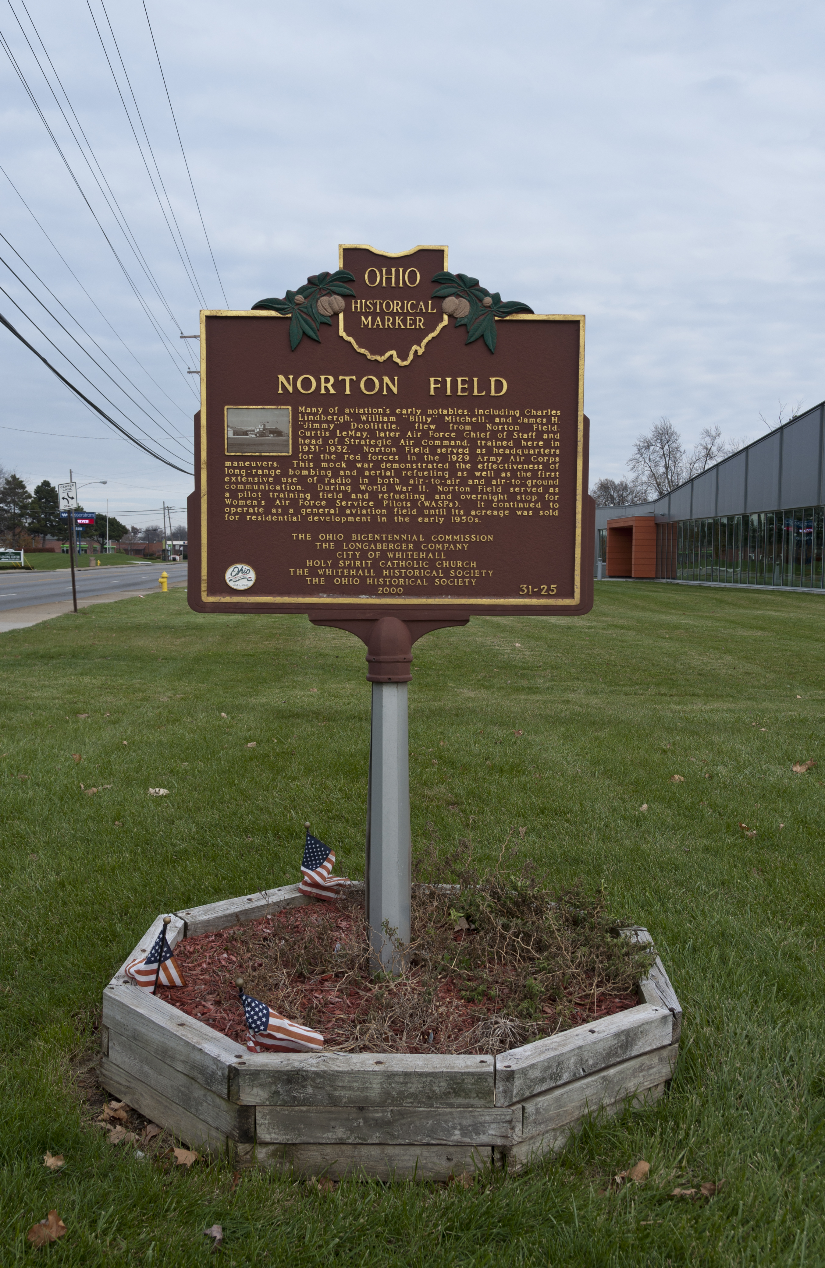
English: The Historical Marker for the first airport in central Ohio, Norton Field viewed from the west.
|
||
| Date | |||
| Source | Own work | ||
| Author | Sixflashphoto |
| Camera location | | View this and other nearby images on: OpenStreetMap - Google Earth |
|---|
Licensing[edit]
I, the copyright holder of this work, hereby publish it under the following license:
|
This file is licensed under the Creative Commons Attribution-Share Alike 4.0 International license. | |
|
|

|
This image has been assessed under the valued image criteria and is considered the most valued image on Commons within the scope: Norton Field Historical Marker. You can see its nomination here. |
File history
Click on a date/time to view the file as it appeared at that time.
| Date/Time | Thumbnail | Dimensions | User | Comment | |
|---|---|---|---|---|---|
| current | 16:45, 4 January 2018 | | 2,707 × 4,163 (6.73 MB) | Sixflashphoto (talk | contribs) | Brightness and a bit of Fill light |
| 19:11, 2 January 2018 |  | 2,707 × 4,163 (6.45 MB) | Sixflashphoto (talk | contribs) | User created page with UploadWizard |
- You cannot overwrite this file.
File usage on Commons
The following 5 pages uses this file:
- Commons:Quality images/Subject/Objects/Statues, Monuments and Plaques
- Commons:Quality images candidates/Archives January 06 2018
- Commons:Valued image candidates/Norton Field Historical Marker 1.jpg
- Commons:WikiProject Aviation/recent uploads/2018 January 4
- Category:Photographs by Sixflashphoto/Whitehall, Ohio
File usage on other wikis
The following other wikis use this file:
- Usage on en.wikipedia.org
- Usage on www.wikidata.org