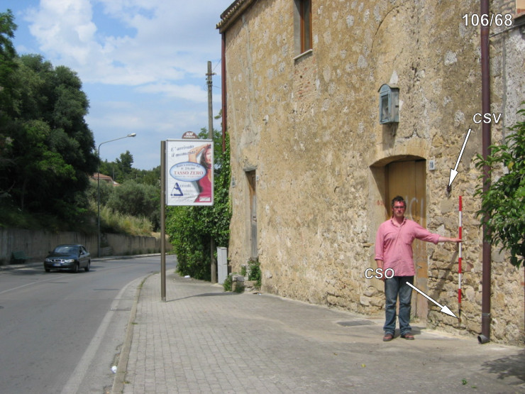
File:Punto di livello altimetrico dell'IGM.jpg
Jump to navigation
Jump to search


Size of this preview: 800 × 598 pixels. Other resolutions: 320 × 239 pixels | 640 × 478 pixels | 1,024 × 765 pixels | 1,280 × 956 pixels | 2,592 × 1,936 pixels.
Original file (2,592 × 1,936 pixels, file size: 2.49 MB, MIME type: image/jpeg)
Summary[edit]
| Description | |
| Date | |
| Source | Own work
|
| Author | OppidumNissenae |
| Camera location | | View this and other nearby images on: OpenStreetMap - Google Earth |
|---|
Licensing[edit]
I, the copyright holder of this work, hereby publish it under the following license:
|
This file is licensed under the Creative Commons Attribution-Share Alike 4.0 International license. | |
|

|
This image has been assessed under the valued image criteria and is considered the most valued image on Commons within the scope: Benchmarks of Istituto Geografico Militare - The only CAPOSALDO DI LIVELLAZIONE of Istituto Geografico Militare. You can see its nomination here. |
File history
Click on a date/time to view the file as it appeared at that time.
| Date/Time | Thumbnail | Dimensions | User | Comment | |
|---|---|---|---|---|---|
| current | 11:37, 8 May 2018 | | 2,592 × 1,936 (2.49 MB) | OppidumNissenae (talk | contribs) | User created page with UploadWizard |
- You cannot overwrite this file.
File usage on Commons
The following 7 pages uses this file:
- Trig points and benchmarks
- User:OppidumNissenae
- User talk:OppidumNissenae
- Commons:Photo challenge/2018 - May - Architectural iron
- Commons:Photo challenge/2018 - May - Architectural iron/Voting
- Commons:Photo challenge/2018 - May - Architectural iron/Voting/Result
- Commons:Valued image candidates/Punto di livello altimetrico dell'IGM.jpg
File usage on other wikis
The following other wikis use this file:
- Usage on it.wikipedia.org