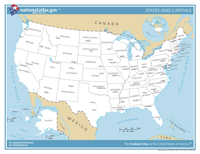
File:US map - states and capitals.png
Jump to navigation
Jump to search


Size of this preview: 776 × 600 pixels. Other resolutions: 311 × 240 pixels | 621 × 480 pixels | 994 × 768 pixels | 1,280 × 989 pixels | 5,499 × 4,249 pixels.
Original file (5,499 × 4,249 pixels, file size: 3.27 MB, MIME type: image/png)
| Description |
States of the United States and their capitals. |
|||
| Date | ||||
| Source | http://nationalatlas.gov | |||
| Author | United States Department of the Interior -- National Atlas | |||
| Permission (Reusing this file) |
|
List of images provided by user Duesentrieb (This link helps me to find all my images) -- Duesentrieb
File history
Click on a date/time to view the file as it appeared at that time.
| Date/Time | Thumbnail | Dimensions | User | Comment | |
|---|---|---|---|---|---|
| current | 15:03, 12 October 2017 |  | 5,499 × 4,249 (3.27 MB) | Runner1928 (talk | contribs) | Higher resolution |
| 15:10, 12 November 2004 |  | 1,584 × 1,224 (233 KB) | Duesentrieb (talk | contribs) | US-States and their capitals; Dept. of Interior, Public Domain |
- You cannot overwrite this file.
File usage on Commons
The following 6 pages uses this file:
File usage on other wikis
The following other wikis use this file:
- Usage on es.wikibooks.org
- Usage on gag.wikipedia.org
- Usage on te.wikipedia.org
- Usage on www.wikidata.org
