File:VelikiStol Mountain from Slovenia.jpg
|

|
This image has been assessed under the valued image criteria and is considered the most valued image on Commons within the scope: Veliki Stol (Hochstuhl) Mountain. You can see its nomination here. |
|
Summary[edit]
| Description |
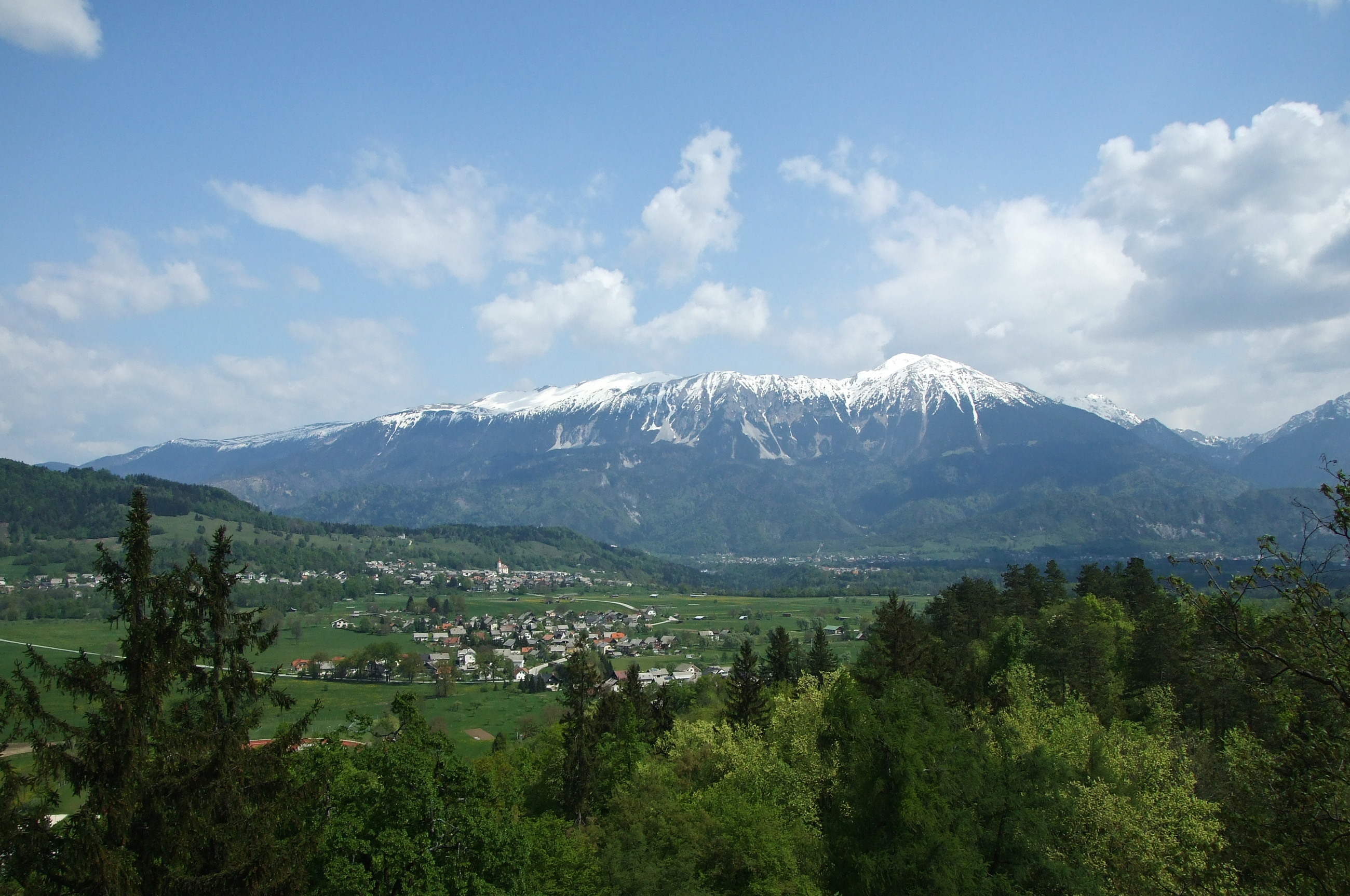
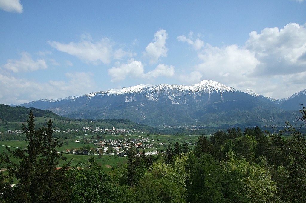
English: Veliki Stol Mountain, part of Karavanke range, as seen from the Bled Castle, Slovenia. The highest peak Stol (Hochstuhl) with its 2,236 m (7,336 ft) can be seen on the right. In the foreground the suburbs of Bled town can be also seen as well as Zasip village with its Parish Church of Saint John the Baptist. The Sava Dolinka valley spreads between the settlements and the mountain. The mountain ridge defines the border between Slovenia and Austria.
Français : Le mont Stol, un sommet de la chaine des Karavanke, vu depuis le château de Bled, en Slovénie. La crête de cette chaine constitue la frontière entre la Slovénie et l'Autriche. Au premier plan, la périphérie de Bled est visible devant le village de Zasip
Slovenščina: Gora Stol v Karavankah, pogled z Blejskega gradu. V ospredju so obronki Bleda in vas Zasip z župnijsko cerkvijo sv. Janeza Krstnika. Med naselji in grebenom je dolina Save Dolinke.
|
| Date | |
| Source | Own work |
| Author | Plamen Agov (user:MrPanyGoff) |
| Permission (Reusing this file) |
If you want to use the image outside the Wikimedia projects, please inform me via my Talk Page or E-mail to specify the way of attribution. |
| Camera location | | View this and other nearby images on: OpenStreetMap - Google Earth |
|---|
Licensing[edit]
 |
This illustration was made by MrPanyGoff
Please credit this : © Plamen Agov • studiolemontree.com in the immediate vicinity of the image. If you use some of my photos, an email to
Do not copy this image illegally by ignoring the terms of the license below, as it is not in the public domain. |
|
This file is licensed under the Creative Commons Attribution-Share Alike 3.0 Unported license. | |
| Attribution: Plamen Agov • studiolemontree.com | ||
|

|
Permission is granted to copy, distribute and/or modify this document under the terms of the GNU Free Documentation License, Version 1.2 or any later version published by the Free Software Foundation; with no Invariant Sections, no Front-Cover Texts, and no Back-Cover Texts. A copy of the license is included in the section entitled GNU Free Documentation License. |
| Annotations | This image is annotated: View the annotations at Commons |

File history
Click on a date/time to view the file as it appeared at that time.
| Date/Time | Thumbnail | Dimensions | User | Comment | |
|---|---|---|---|---|---|
| current | 14:04, 24 February 2011 | | 2,600 × 1,726 (2.75 MB) | MrPanyGoff (talk | contribs) | {{Information |Description ={{en|1=Veliki Stol mountain part of Karavanke range as seen from the Bled castle, Slovenia. The highest peak Stol (Hochstuhl) cen be seen in the right.}} |Source ={{own}} |Author =[[User:MrPanyGoff|MrPanyGoff |
- You cannot overwrite this file.
File usage on Commons
The following 10 pages uses this file:
- Stol (Karawanks)
- User:MrPanyGoff
- User talk:MrPanyGoff/Archive
- User talk:MrPanyGoff/Archive 2
- Commons:Quality images/Subject/Places/Natural structures
- Commons:Quality images candidates/Archives January 2012
- Commons:Valued image candidates/VelikiStol Mountain from Slovenia.jpg
- Commons:Valued images by topic/Places/Natural/Mountain sites
- File:Bled Overview.JPG
- File:VelikiStol Mountain from Slovenia.jpg
File usage on other wikis
The following other wikis use this file:
- Usage on bs.wikipedia.org
- Usage on cs.wikipedia.org
- Usage on en.wikipedia.org
- Usage on eu.wikipedia.org
- Usage on it.wikipedia.org
- Usage on lt.wikipedia.org
- Usage on sl.wikipedia.org