Alistair Massarella co-founded CRFS in 2007. As Executive Chairman, Alistair’s passion for engineering means he continues to play an enthusiastic and active role in the day-to-day technology developments at CRFS.
Previously, Alistair co-founded the radio telecoms company Adaptive Broadband Limited in 1997 which was sold to California Microwave (now Adaptive Broadband Corporation) in 1998. Alistair then co-founded Cambridge Broadband Limited in 2000. Alistair has a PhD in telecommunications engineering from British Telecom Research laboratories.
Q. Can you tell us a brief history about CRFS? And how the company has evolved over the years?

CRFS was founded in Cambridge, UK in 2007 with the aim to revolutionise and modernise the way RF spectrum is monitored and managed. We have a great team of engineers working to push the boundaries of the possible in the RF monitoring world. This has allowed our evolution to be pretty rapid. We’ve now deployed over 2000 Nodes worldwide and we have a lot of repeat customers who just rave about our technology and the agile customer responsive service we offer. We hope to bring the same benefits to even more clients in the spectrum monitoring field in the future.
Q. What Products & Services do you provide?
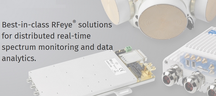
We provide intelligent, field-deployable RFeye® Nodes, antenna arrays and various portable systems (e.g. backpacks) for RF monitoring.
This RFeye® technology delivers extremely high performance at a form factor far below anything previously achievable. Our Nodes are optimised without compromise meaning SWaP-C optimised without compromise on performance or speed.
Q. What Market Segments do you serve/target?
Well, essentially anyone wanting real-time 24/7 spectrum monitoring and the associated applications like data analytics, direction finding and geolocation.
But a lot of our customers fit into the “Market Segments” of regulatory authorities, military, security (such as government intelligence agencies) and OEMs who take advantage of our receiver boards.
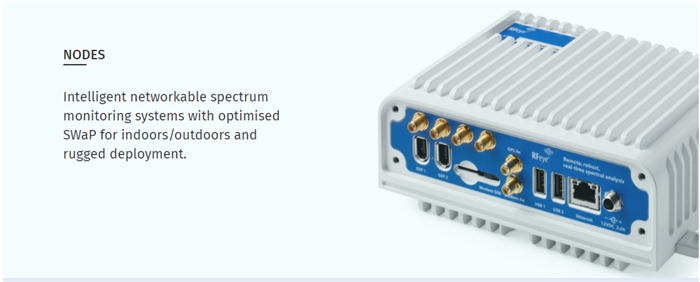
Q. What is the RFeye? Can you tell us more about the technology and philosophy?
It’s all about design in specific response to customer feedback, both in terms of delivering optimised high performance technology and in terms of how we work closely with customers to ensure the right solution for their problem.
So, as I mentioned earlier, our RFeye® technology is fantastically high spec at a size that most of our customers don’t believe is possible until they see it. This technology is also truly intelligent with Nodes’ on-board software allowing them to run autonomously.
Distributed, modular and scalable networks is another key principle allowing networks of one or hundreds of Nodes distributed across wide areas for remote connection. This gives customers full flexibility in how they conduct their spectrum monitoring or geolocation missions
All products are also COTS-designed to ensure sustainability, evolution and low cost.
Q. What are the products and technologies that you have developed based on the RFeye technology/platform?
There are a wide range of applications which have been enabled by the development of this small form factor and low entry cost node. Some examples include:
- Full line rate signal capture and interrogation for intelligence and EW applications
- Massive data capture capacity for forensic analytics and big data enablement
- Real-time geolocation of multiple targets and 3-D geolocation detection
- Pre-deployment simulation and solution optimisation using propagation modelling tools.
Prior to RFeye, these applications were not feasible for many users owing to the size and/or cost of the equipment needed.
Q. Threats from commercial drones have significantly grown lately. What test & measurement solutions from CRFS can be used to address these threats?
Most government and military need no reminder when it comes to the tactical impact presented by drones operated by either nuisance civilians or deliberate action from opposition forces. Indeed, it presents a unique threat in many ways – there is a rush to develop and deploy strategies and solutions to counter them.
While some have tried to claim that RF monitoring is the ultimate solution, CRFS assert that a multi sensor approach provides the most reliable solution to detect, locate and counter commercial drones.
CRFS are uniquely placed to provide an RF monitoring component to complement existing radar and electro-optical systems. We have demonstrated the value of RF detection in many scenarios now with both military and system integrator customers.
Q. CRFS has developed DRFM (Digital Radio Frequency Memory) Solutions. Can you tell us more about this technology and the solutions?
Enhancements in technical capabilities such as wider frequency range detection and instantaneous bandwidth mean that the nirvana of being able to deliver a DRFM solutions are coming ever closer. CRFS recognise that this represents significant technical challenges (backhaul speed, data storage capabilities) and we are currently working with lead customers to deliver working solutions. Our engineering teams are truly at the bleeding of edge of both computing and hardware technologies at this stage and we are delivering amazing results so far. Our PCIe and Thunderbolt technology enables the data rates needed to provide DRFM solutions for both rack-based and desktop systems.
Q. What makes your geolocation and direction finding systems better than the other systems available?
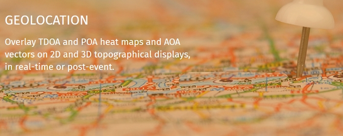
Of course, hardware specs such as noise figure means we can provide greater accuracy and cover ever wider regions. Processing speed is also a big stand out feature – our update rates of tens per second enable truly real-time geolocation, while other products are still providing updates at maybe once every 30 seconds!
Looking at some more specific features, we’re now developing advanced applications such as 3-D geolocation, offline and post processing geolocation from silent nodes. Our open architecture also means that real-time geolocation data can be output to 3rd party systems such as command and control and effector systems.
Q. What is the 'Cumulative Tracking' feature for Direction Finding Vehicles?
The cumulative tracking feature means that instead of performing Direction Finding with 2 fixed antenna arrays or more, you can geolocate using multiple bearings from a single mobile antenna array e.g. fixed to a Direction Finding Vehicle (DFV). Cumulative bearings are plotted in real time on a map to provide rapid and accurate location. Our modularity means that a DFV can be used in combination with any fixed antenna array you may have and/or additional DFVs.
Q. Software seems to be an important part of most CRFS Solutions. What kind of software do you provide with the RFeye Solutions? How can users get access to software tools they need for their applications?
CRFS provides 3 broad software solutions.
Real-time spectral monitoring, signal interception, geolocation etc. via a windows-based environment that most users are highly familiar and comfortable operating in. This software has advanced capabilities to overlay geolocation data, signals analytics and spectrum data basing features.
For 24/7 monitoring missions, we have resident applications which work independently on the node in the ultra-stable Linux environment. This is what gives Nodes their intelligence allowing you to leave them to just get on with the job without intervention.
Finally, for users in their own software environment, or OEM applications, CRFS provide a wide range of software tools including APIs, embedded functionality and SDKs for applications such as MATLAB®.
Just tell us what bits of software you want or explain what you want to be able to do and we’ll make sure you get what you need.